Saturday, May 4, 2013

Mt. Cabuyao and Mt. Sto. Tomas near Baguio City

So you've been to Baguio more times than you can count. You've been to the Cathedral, had your picture taken with a St. Bernard dog or horse at Mines View Park, picked strawberries at the Strawberry Farm in Benguet and enjoyed the many restaurants in Session Road and the newer ones in SM Baguio.

The biker in you wants to explore the fringes of the city. You want to suck the pine scented air deep into your lungs and you go read the map, plot your course and head out on your bike. Just out the gate, you play with the mist from mouth as it meets the cold chilly air.

And then you pedal, slowly at first, then when you get to a straight road, you pedal hard. Your sides ache and you grab your chest as it spasms as it adjusts to the high altitude when you tried to pump it hard.

This is how I imagine it to be if I brought my bike to Baguio for my family vacation. However, the wife and I had two small kids with us and we rode a bus so bringing a bike was not an option.

MT. BIKE TRAILS IN BAGUIO

I was able to go out on my own though to run (I'm currently training for my first 32-km run). From our base at Hotel 45, I was able to go out and run on South Drive which is perfect because it doesn't have a lot of car traffic and it's fairly woody so the pine scent is strong. I ran all the way to Wright Park to Mines View Park then down to Gibraltar Road then onwards to Leonard Wood road to go back to the hotel. It was a 10 km. route and bikers could also enjoy this woody/hilly route.

Camp John Hay has the Eco-Trail. At almost 2 kms, the route is great for trail running or just to go out for a walk in the woods. This trail is OFF-LIMITS TO MOUNTAIN BIKERS though and rightly so because small kids are also using the trail.
Camp John Hay's Eco Trail is almost 2 kms long, you can't ride your mountain bike here though, that's my son right there :D
But that's OK since there's an option for us which is the Horse Trail just behind the line of shops near the Le Monet hotel where the Titania Wine store and Shakey's restaurant are. A guard confirmed that mountain bikers can use the Horse Trail and a horse guide told me this trail was around 2 kms. long but you can go on further to another area to lengthen your ride. I'd love to go back there and explore this trail on my own someday.

Hiking and Running Up Mt. Cabuyao and Mt. Sto. Tomas


The main reason for this entry is my trip up to Mt. Cabuyao and Mt. Sto. Tomas on our last day in Baguio. I took a hint from PinoyMountaineer's entry as I always do and followed the itinerary. I left the hotel around 0515 and found the jeep terminal to Green Valley which is located behind Hotel Veniz which is near Burnham Park.

The jeeps seem to start their trips at 0600 so I had time to eat breakfast at the carinderia (cantina) just in front of the terminal. The jump off point is the police station at Sto. Tomas road and if you see a policeman just say hi and that you'll be going up Sto. Tomas as a courtesy. The road is actually well maintained but there are some sections that are being rebuilt near the 3rd km from the jump off.


Farmer watering his field near Mt. Cabuyao


You can run up this mountain because it's well paved

Off limits! But there's a view deck and the entrance is near this gate

At the fifth kilometer you'll be at the summit of Mt. Cabuyao where the huge discs of the radar installation are. These Mickey Mouse ear radar can be seen when you go back down to Kennon Road going back to Manila. It's off limits though but go close to the gate and there's a sign there that points you to the View Deck.You'll pass by a trail that hugs the chicken wire fence until you get to the View Deck. It was foggy when I got there so I wasn't able to enjoy the view much so I can't say what you'll be able to see there.

Onwards to my hike/run and the antennas that mark the summit of Mt. Sto. Tomas are visible, past the seven kilometer mark, you'll reach the dirt road. Congratulations, your knobby tires are now home in mountain bike territory.
M.I.C.K.E.Y. M.O.U.S.E. Mickey!
The view is amazing, the plains are to your right and the mountains are to your left, you'll go past terraced fields where farmers work the land. Keep pushing forward and you'll get to road portions that are being paved (awww, but that means progress for the locals). There are some junctions but just follow the wider road. 4x4 vehicles that workers use to go to the towers help keep the trail navigable.


Pack light! All I had in my pocket was a 330ml bottle of water, two cupcakes, a camera and my phone for GPS tracking. I planned to hike/run this road so I didn't bring much.

Take the right road to go up to Sto. Tomas. I was told the one going left  was a wilderness trail that went straight to Kennon Road Camp 6, I should try it next time

I finally got to the summit of Mt. Sto. Tomas after two and a half hours, it's 10.32 kms away from the jump off point (police station) and 5 kms away from Mt. Cabuyao. It's foggy up there and there's a cross marker for the summit but you'll have to look for it inside where the communication towers are. There's some staff there so it's always good to let them know why you're there.
Some mountain bikers going up to Sto. Tomas

Hey! See? You can ride your bike up to Sto. Tomas (pardon my big finger on the lower left)

Mt. Sto. Tomas summit marker, it was put up there to  celebrate 400 years of Christianity in the Philippines

I might not have taken my bike up to Mt. Sto. Tomas but I can confirm that it is indeed navigable by mountain bike. You'll need an extra pair of legs because the hills can be a killer, I bet i'd need to push my bike up there if I bring it up there but I'm sure you guys can do it easily. :)

TIPS AND TRICKS TIME!

Itinerary for hike/run up Mt. Cabuyao (MASL 2025) and Mt. Sto. Tomas (MASL 2256)
0600 - Depart Baguio to Green Valley (station is behind Hotel Veniz near Burnham Park, 15 pesos fare)
0630 - Jumpoff (police station at Sto. Tomas road)
0735 - Mt. Cabuyao summit (Km. 5.35 from jumpoff)
0750 - Gravel section (this is where your mountain bike will be happy)
0850 - Sto. Tomas summit (Km. 10.32 from jumpoff)
1010 - Back at jumpoff (ran most of the way down with stops along the way)
11:00 - Back in Session Road (it takes some time to find a jeep from jump off and I had to run/walk closer to the main road)

Note: Distance data is based on GPS data from Endomondo app, also according to the app, Mt. Cabuyao is at 2047 MASL while Sto. Tomas is at 2298

We stayed at Hotel 45's new building (online reviews recommended the new building and that's what I'll also recommend) It's a just a hop, skip, and a quick car dodge away from SM Baguio, it was reasonably priced too with hot shower, free breakfast and Wi-Fi at 1,100 per night, staff are cool too.

Friday, April 19, 2013

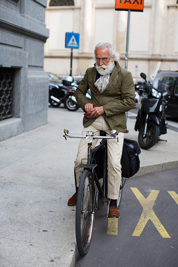
More people on bikes from The Sartorialist

I visited The Sartorialist site again to look for more pics of people on bikes and I wasn't disappointed.

This is not the first time he's been featured on the Sartorialist and I believe I posted his pic in the past

Bowties and bikes

Saturday, April 6, 2013

Marine Base in Ternate, Cavite AKA Mt. Palpag (Palpak) trip.

Last month, me and my buddies planned to go for another bike and hike trip to Mt. Palpag in Maragondon, Cavite. We met up at around 7 in the morning near the Mall of Asia and rode the bikes all through Las Pinas, Bacoor, Naic, then Maragondon. We should have gone straight here (I guess) and not turned right to Ternate where we could not find a good local source to get some info on how to get to Mt. Palpag.

It was around 3 PM when we got to Ternate (slow, I know, but we had a lot of stops along the way to just dick around) and with not a lot of time left, we did not want to risk going into an unknown trail and getting lost so we decided to go straight and look for the Marine Base in Ternate, Cavite.

We pushed our bikes slowly up to the DENR station where the jump off to Pico de Loro is, (you mountaineers know this of course). It was already dark when we got there and I got the chance to try my new Energizer headlamp while riding the bike.

IT WORKED GREAT! My buddies and I were impressed by how bright it was. I bought the headlamp after our last failed attempt to climb Mt. Sembrano where we had to run down the trail from the mountain in near darkness. For around 500 pesos, it ain't bad!

Back to my story, we finally got to the Marine Base at around 7 PM I think. The soldier at the gate collected Php600 from the three of us (the entrance is just Php100 if it's not overnight, Php200 is the overnight rate). There's also a fee for pitching your tent at the beach but they do have rooms that you could rent out but we had our tents with us and we planned to camp out on the beach.

The beach is far from the gate, I celebrated prematurely when I reached the gate thinking I could get some chow soon but it turns out the beach is over 4 kms. away from the gate. It was all down hill so at least that made it easier.

Finally! The beach! Like any beach in the Philippines, there's bound to be a videoke. THERE'S ALWAYS A VIDEOKE IN THE BEACH. There's a store there where you could get cold Coke and other food so that helped.

My friend Jeff made quick friends with some of the carpenters who were working at the base. We shared our dinner of sandwiches with corned beef and cheese AND COKE! I finally had to excuse myself so I could sleep inside the tent.

Morning time and while there's no bugle call in this Marine camp, you could observe the Marines doing their drills on the beach and in their barracks nearby. Be aware though, that you're not allowed to take pics of the soldiers for obvious reasons.

What's nice about the Marine Base's beach is the white sand. It's also long and wide and the water isn't that deep. You could see Corregidor and Bataan from the beach. We took a dip in the beach after breakfast until it was time to pack up and leave.

On the way home, it was good to see a troop of monkeys right after we got out of the gate. This area is in fact part of the Mt. Palay Palay reserve and it's nice to know that wildlife is indeed being given a good sanctuary here.

Tips and tricks time!
1) We FAILED to find the trail to Mt. Palpag. In fact, we're calling this trip the Mt. Palpak (failure) trip. If you know how to go to Mt. Palpag, lemme know in the comments.

2) Entrance at the beach is Php 100 per head for day trips, Php 200 for overnight. There are rooms available but this could be hard to get hold of during weekends. I don't know if you could reserve a room. It might help if you have a cadet in the camp.

3) Total distance is over 80 kms all the way to the Marine Base. If you want to camp on the beach, there's a fee for pitching the tent.

4) DO TRY THE LOLO CLARO's RESTAURANT along the way. They serve great chicken that could give Max's Restaurant a run for their money!

5) When we made the trip, the Nasugbu-Ternate tunnel was already open so it's now possible to make a roundtrip using that route.

Early meetup near MOA

We weren't able to reach our original goal of Mt. Palpag

I'll ride my bike anytime with these guys

Fresh air!


Around 80 kms from Manila, the Marine Base camp in Ternate is close enough for a quick beach trip

We pitched our tents right on the beach


Wednesday, March 6, 2013

Phone charger for your bike

I recently rode the bike over 150 kms in two days to Ternate, Cavite with some buddies and we tracked our ride with our phones that are equipped with the Endomondo app. Well, what do you know, our batteries can't last that long. So I've searched the net for a dynamo hub that can do the job of keeping my phone juiced. And hey! Check it out! I found Dahon's BioLogic *ReeCharge* power system. According to its press release, it connects to all dynamo hubs on the market and then regulates the power it produces to charge the high capacity lithim polymer battery of the system. This power is then used to power up your device via USB. Hot dawg I need this sh.. Shproduct...

Read the press release here.

photo credit: Dahon's press release

Saturday, December 8, 2012

Mt. Makiling (11-25-12)

I was finally able to climb Mt. Makiling after dreaming about it and pestering my friends to go with me up the mountain. This is my first hike that is higher than 1,000 MASL and I'm so glad I went through with it even if I had to do it alone since my buddies did a climb a week earlier. My brother-in-law lives in Calamba and I was able to commute from his place to UPLB via the jeep terminal in the market near Calamba crossing. What does this have to do with bikes? Well, I also thought about riding my bike from Calamba to the jump off but thought twice since climbing a mountain is strenuous by itself and I would be doing it alone.

I started my hike up the mountain at 7:35 AM and paid 10 pesos at the gate. (Super cheap!) Can you bike up Mt. Makiling? I saw and chatted with mountain bikers up until Agila Base (around midway point of the 1,090 MASL mountain) and the trail going up there would be around 4kms from the jump off point at the UPLB Forestry gate. The trail is a wide dirt road that keeps narrowing down to an almost single track road. There's even a fallen tree trunk just before the Agila Base site. After Agila Base, I don't recommend going up since it's not mountain bike friendly but perfect for hikers.

Hiking up the mountain, there are stores you can get refreshments from like coconut and softdrinks, and you can visit the Flatrocks and the Mudspring but I wasn't able to visit these sites when I went up there. YOU HAVE TO WATCH OUT FOR LEECHES! One bit me and fortunately it wasn't able to get past my socks and I felt it immediately before it got to eat lunch at my expense :P I had a salt shaker in my pocket for exactly this situation and I sprinkled the little guy with salt til it squirmed and i was able to pinch it off with a leaf. This is one of the dangers of the mountain and there's also a plant there that is itchy when you touch it. Like my other hiking trips, I used Pinoymountaineer's entry to guide my trip and you should too :)

I left my brother-in-law's place very early! Makiling was still covered in clouds here.

Coconut! Nature's Gatorade!

The trail's wide enough for cars, this is near the mudspring junction


Sweet, sweet water... These are the things that I absolutely love when hiking!

Yep, still rideable

oh sweet!

The fallen tree just before Agila Base

See? They made it up to this point! :D

After Agila Base, this is what the trail looks like, NOT rideable and please, let's keep it pristine :D

These *might* be leeches

summit! Finally :D

No view at the summit, I had to climb up a tree to see some views :D

More views up a tree


Saturday, November 3, 2012

14th Tour of the Fireflies (2012)

The 14th Tour of the Fireflies is coming up! This year's tour has been rescheduled twice already, it was originally scheduled last April 15, 2012 then moved to September 16, 2012 and again to November 18, 2012. According to their FAQs page, you can participate in the tour for free but you can also make a minimum donation of Php 100 (highly recommended) and you can register online. OR you can also do a walk in registration at their headquarters in Cubao Expo.

This year's theme is BEST which stands for Bicycles for Environmentally Sustainable Transportation and the tour will start and end in Tiendesitas, Pasig (like previous tours) and assembly starts at 5:00 AM and the ride off will start at 7:00 AM. Riders of all ages are welcome but the kids should of course be accompanied by their guardians.

They always come up with great looking posters and this year is no exception! The cartoony pic also adorns this year's shirt and jersey which you could get for Php300 and Php450 respectively. Get more info on this tour from their official site and their Facebook page.

Saturday, October 27, 2012

Mt. Sembrano Bike & Hike (October 27, 2012)

We just had another long weekend here in the Philippines and I HAD to go somewhere because A: It's a long weekend and B: My birthday is coming up. So a week before I was able to convince my friends to bike and hike to Mt. Sembrano in Malaya, Pililla. The plan was for the three of us to leave from my friend's place in Quezon City and bike to Antipolo, down to Teresa, and left towards Tanay from Morong last Friday (October 26, 2012). One of my buddy had to beg off since his daughter was sick so the trio was down to a duo and with the storm Ofel having just exited the country, I had to also cancel because it was raining.

So, the trip was moved to the next day and me and my buddy left his home around 7:30 AM, had some breakfast and pushed on towards Antipolo first but not before he got a punctured tire. Having fixed it, we pushed on up to Antipolo then down to Teresa where we got this beautiful view of Morong.


The downhill portion was great going down to Morong but our tummies grumbled and so we stopped at a store for buko juice and some biscuits before rolling out to Baras for lunch but not before taking some more pics of Laguna De Bay.

I swear a bunch of fish were jumping up from the water


We finally got to Malaya, Pililla in Rizal at around 1:15 PM (I know, we won't win any medals for speed) and registered at their Brgy. Hall and asked them kindly if we can leave our bikes as we hike up the mountain. They let us park our bikes in their stock room/ kitchen and they even took note of what we left in their log books so we know the bikes are safe there. 
Saaaafe!!!

We paid 20 pesos each and got their number (09192282804) in case of emergencies. We were told the hike would take an hour and a half since we looked fast but this was not the case as you'll learn later. So we started on up for the hike portion of our trip, I bought just a liter of water from a store and two biscuits. The first km or so was a concrete road that then cuts off to a rocky portion. Bikeable? Maybe, but not really. There's a fork somewhere and we stupidly picked the wrong side (three times in the whole trip) even though we've been told at the registration to ALWAYS choose the path to the right at the Brgy. hall. I stacked some rocks (as a cairn) to the right path since no one thought of doing so.

I've always been worried about the time since we started the hike late already (1:20 PM) and getting lost in those forks took some time too. Up and up, we were able to cool ourselves from the brooks that intersect the path. We got to the manggahan (Mango farm) portion where we paid another 10 pesos to the caretaker (we were told at the Brgy. hall that they forbade this already though) and continued up to this portion. Bikeable? Definitely not.
No, you can't ride your bike here


The problem was my buddy's water ran out and he didn't have any food so I had to share my water and cookies with him when we got tired plus my bum knee started to get sore again going up. We were only able to reach the first camp site near the summit because we were so darn tired/ out of water/ out of food but what a sight! We laid on the grass in exhaustion until we got the energy to take a look around and take pics.


Hey! We biked that road!

The Malaya power plant


There's the summit! We didn't quite reach it, but there's always next time :)
We reached this point around 4 PM (3 hours 40 minutes) and it's not even the summit! We had to go back down and fortunately, the caretakers at the manggahan portion sold buko juice for 10 pesos each and we refueled on that before running down the mountain as the light faded fast. By the time we reached the concrete portion, it was really dark and we logged out at the brgy. hall and got our bikes to get some chow at a nearby carinderia (small cantina). We pushed on back to Manila (Mandaluyong for me, QC for my friend) at 6:45 and I got home almost 1 AM. Phew. what a tiring, tiring, but happy day.

Tips and tricks portion!
1) Yes, you can bike all the way to Malaya, Pillila Rizal which is the jump off to Mt. Sembrano and leave your bikes there. The registration is 20 pesos.
2) Mt. Sembrano is 745 MASL according to its PinoyMountaineer entry which I also used as reference for this trip.
3) Distance from QC to Malaya, Pililla is around 50 kms when i measured it with Wikimapia but God how I wish I have a GPS or cyclocomp to give you guys a more accurate info.
4) We were told that the jeep fare from Crossing Shaw in Mandaluyong to Tanay is 53 pesos and the jeep from Tanay to Malaya is another 20 pesos. If you've been there, let us know your travel time in the comments.
5) Yes, yes, yes you can do Mt. Sembrano as a day hike or a bike and hike a day but you have to be extra tough just bring lots of water and munchies. Use a road bike or use skinny tires on your mountain bike.
6) Bring blinkers and headlamps (you can use it on your way down the mountain and as you ride back home most probably at night)
6) No, you can't ride your MTB up to Mt. Sembrano.